TIMES JATIM, TULUNGAGUNG – Having a vacation while enjoying and learning the beauty of natural phenomena can be a great experience in our lifetime. If you want to enjoy the scenic beauty of nature, going to several geosites in Tulungagung can be a great idea.
Here are the lists of 19 geosites in Tulungagung based on the research conveyed by the Geological Survey Central Team of Bandung Geological Agency released in 2022. These geosites were proposed to be the geoheritage sites in Tulungagung’s geopark area named The Home of Wajak Man.
1. Hypostratotype Formation of Niyama River
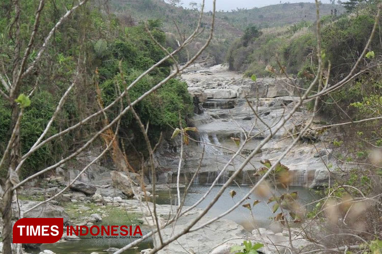 Niyama River in the dry season. (Photo: Benny S/TIMES Indonesia)
The first geosite is located in Besuki Village, Besuki sub-district. In this location, there is a terraced waterfall caused by geological fracture.
2. Diorite of Mount Tanggul
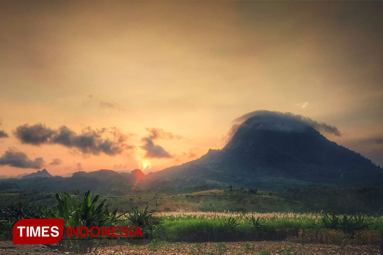 Geosite of Mount Tanggul. (Photo: Benny S/TIMES Indonesia)
This geosite covers two villages, namely Besuki and Keboireng in Besuki sub-district. The geosite is in the form of a cone mountain that can be seen from afar.
3. Gearology Cave Song Gentong
This geosite is located in Besole Village in Besuki sub-district. It is in the form of a twin limestone tower with a cave in each of the towers. There are traces of ancient humans from 5000 to 7000 years ago found in this area in the form of stone tools, bone tools, ornaments made from mollusk shells, and pottery shards.
4. Sanggar Beach
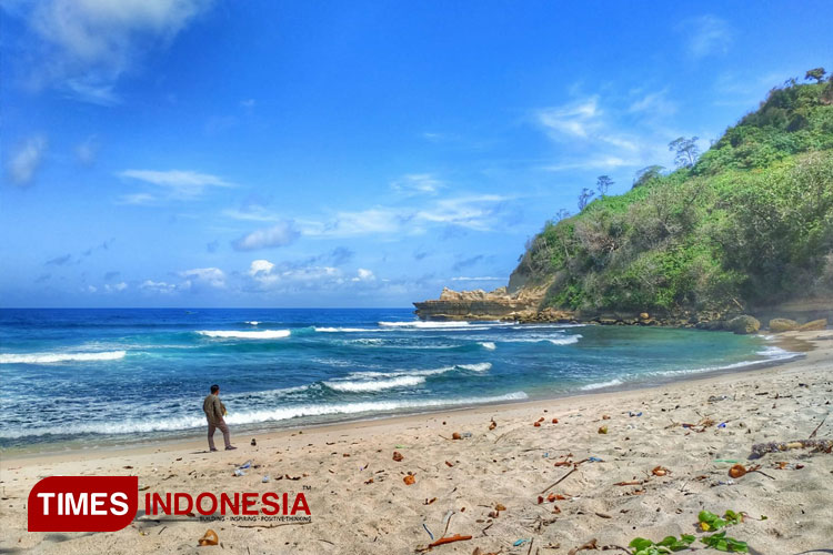 Sanggar Beach with white sands and blue ocean. (Photo: Benny S/TIMES Indonesia)
Sanggar Beach is a beautiful beach with white sands located in Jengglungharjo Village, Tanggunggunung sub-district. There are layers of stone in its coastal cliffs containing fossils, such as planktonic foraminifera, benthic foraminifera, coral reefs, ancient crabs, and traces of ancient fossils.
5. Ngalur Beach
Ngalur Beach is exactly next to Sanggar Beach. The southeast side of this beach keeps the fossils of slumbergerella foraminifera and many kinds of coral reefs.
6. Tenggar Cave
This cave is located in Tenggarrejo Village, Tanggunggunung sub-district. This cave is an active subterranean river with many developing stalactites and stalagmites.
7. Buret Lake
This lake is located in Sawo Village, Campurdarat sub-district with a size that covers up to 30 x 40 meters. It is an outlet of the water system flowing from the limestone hills around it. That’s why this lake is never dry.
8. Morphostructure of Mount Pegat
This geosite is also in Sawo Village that exists in the form of limestone hills.
9. Wajak Gearology Cave
This site is located in Gamping Village, Campurdarat sub-district. The cave’s ceiling caved in, creating a big crater that exists to this day. The most interesting fact of this site is that it has a scientific record that explains the early life on Java island.
10. Eruption Deposits of Mount Blejet
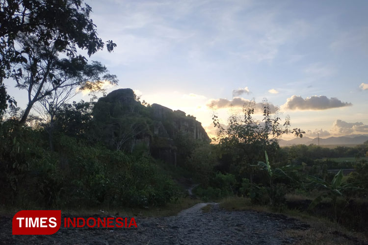 Afternoon scenery in Mount Blejet in Tulungagung. (Photo: Benny S/TIMES Indonesia)
Located in Pelem Village, this mount keeps a scientific record as the proof of geological phenomena, submarine volcanic activity in the end of Oligocene and early Miocene period. Mount Blejet is the early phase of Budheg Mount formation.
11. Mount Budheg
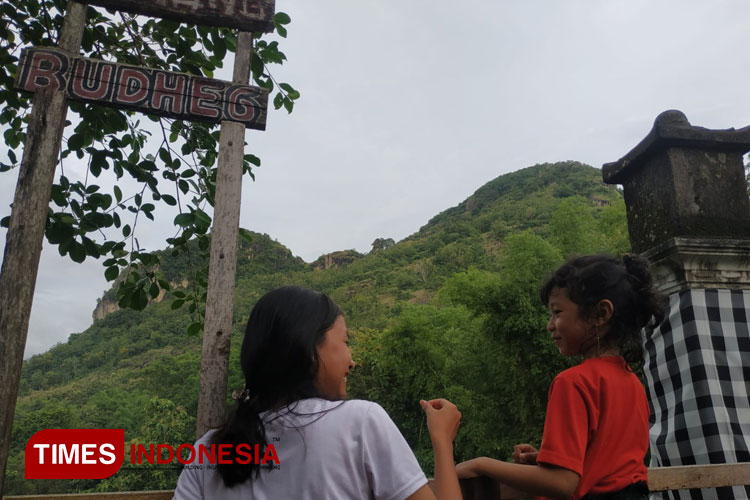 Children are enjoying the scenery in Mount Budheg. (PHOTO: tulungagungdaring.id)
This ancient mountain is located in Tanggung Village, Campurdarat sub-district. Mount Budheg has a unique panorama in the form of an ancient cone volcano in the middle of a vast plain.
12. Deposit of Sidem Sea Submarine Landslide
It is located in Sidem Village, Gondang sub-district. Surrounded by dark grey breccias formed at the end of the Oligocene period. Seen from a scientific point of view, this geosite was formed by an ancient submarine landslide.
13. Wilis Volcano
Located in Gambiran Village, Pagerwojo sub-district, this geosite is in the form of Tretes Waterfall that reaches 9 to 11 meters in height. There are stones formed from volcanic breccias, agglomerate, and lava from Mount Wilis.
14. Kedung Tumpang Beach
This limestone beach has small craters like pools. It is located in Pucanglaban Village. Seen from a scientific point of view, this site was an early formation of environmental change that affected the formation of Wonosari limestone. The craters in the beach were formed by the turbulence waves.
15. Skarn Watu Ijo
This geosite is located in Panggunguni Village, Pucanglaban sub-district. It was formed by the process of limestone alteration into skarn caused by the hydrothermal heating passing the stones.
16. Winong Geosites
This geological site is located in Winong Village, Kalidawir sub-district. It is in the form of a 30-meter hill. There were many tools made of mollusk shells and traces of fossils.
17. Cemenung Hills
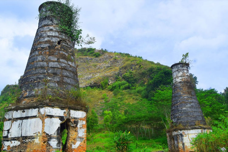
Located in Tenggong Village, Rejotangan sub-district, this geosite is a solitary hill with a savannah on top that covers up to 7 hectares. This hill was formed by environmental changes caused by volcanic processes.
18. Alam Kandung Waterfalls
This waterfall is 15 meters in height and has a limestone pool with 10-meter depth. This terraced waterfall is located in Tanen Village, Rejotangan sub-district.
19. Sumberagung Andesite
This andesite is located in Sumberagung Village, Rejotangan sub-district, Tulungagung. It has an important value as it is the proof of an intrusion process and alteration process. (*)
| Pewarta | : Tiara Dewanti DJ |
| Editor | : Tiara Dewanti DJ |
